| Code | Water Source Type | Inspecting Agency | Inspection Date | Region | District | Settlement Name | Settlement Distance | Establishing Agency | Establishing Date | Source Name | Latitude | Longitude | Sources Cluster | Water Source Photo | Users | Permanent? | Months Used | Functioning? | Non Function Reason | No of Humans | No of Camels | No of Cattle | No of Shoats | Irrigation Area | Source Protected? | Borehole Depth | Casing Type | Casing Size | Borehole SWL | Borehole Operating Yield | Borehole Operating Hours | Borehole Operating Drawn | Borehole Recovery Time | Dugwell Depth | Dugwell SWL | Dugwell Yield | Dugwell operating hours | Dugwell draw down | Recovery time | Dam depth | Dam length | Dam width | Berkad depth | Berkad length | Berkad width | Spring Cumulative discharge rate | Other depth | Other length | Other width | Other source yield | Reservoir Type | Reservoir Capacity | Pipeline Type | Pipeline Length | HouseHold Connections | Water Point Kiosks | Troughs | Source Emergency? | No of Trucks | Truck Capacity | Pump Type | Pump Model | Pump Capacity | Pump Level | Power Source | Generator Type | Generator Capacity | Solar Type | Solar Capacity | Supply Condition | Supply System Condition Notes | Physical Water Issues | Physical Problem Reason | Temperature | pH | Electrical Conductivity | Total Dissolved Solids | Water Sample Code | Management Type | WSC | WSC Established Date | WSC Male | WSC Female | Watercharged Humans? | Cost Of Water Humans | Watercharged Animals? | Cost Of Water Animals | Last Intervention Agency | Last Intervention Description | Intervention Date | Proposed Intervention Description | Additional Notes | |
|---|---|---|---|---|---|---|---|---|---|---|---|---|---|---|---|---|---|---|---|---|---|---|---|---|---|---|---|---|---|---|---|---|---|---|---|---|---|---|---|---|---|---|---|---|---|---|---|---|---|---|---|---|---|---|---|---|---|---|---|---|---|---|---|---|---|---|---|---|---|---|---|---|---|---|---|---|---|---|---|---|---|---|---|---|---|---|---|---|---|---|---|---|---|
| BHSLCA014 | Borehole | Somaliland_MoWRD | Nov. 11, 2019 | Sool | Caynabo | Barkada Ali xirsi | 5.0 | Chinese Government | 11/10/1986 | Barkada Ali Xirsi | 9.3066 | 46.5048 | 0 | 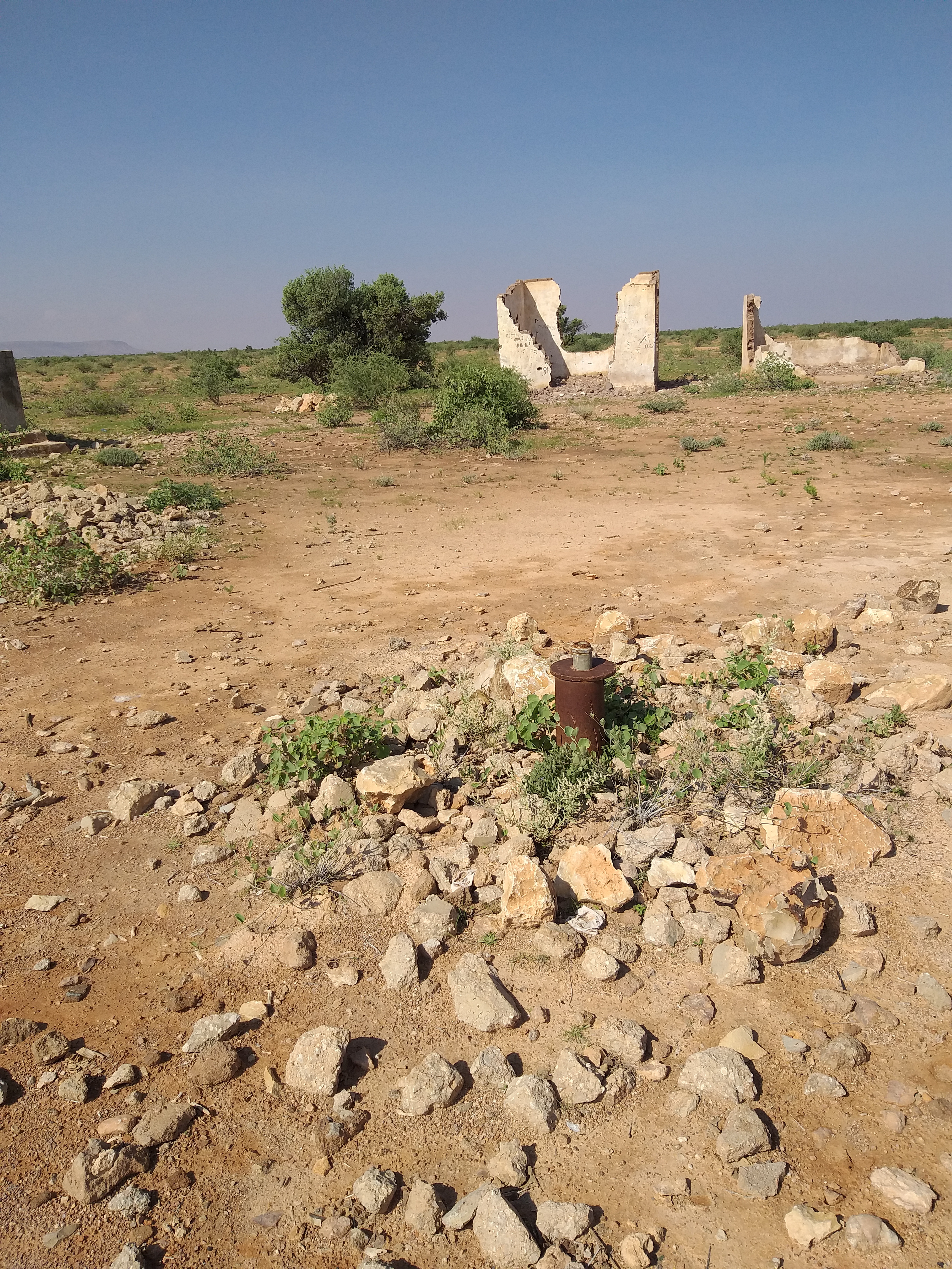 |
Rural | No | None | Abandoned | Since june 1993,this borehole is collapsed and there is no any rasing system that works now | None | None | None | 0 | None | None | None | None | None | None | None | None | None | None | None | None | None | None | None | None | None | None | None | None | None | None | None | None | None | None | None | None | None | None | Invalid: "data.pipeline_lengthe" | None | None | None | None | None | None | None | None | None | None | None | None | None | None | None | Poor | As mentioned above this borehole is non functioned since 1993 due to collapse | No | None | None | None | None | None | No Document | None | None | None | None | None | None | None | None | None | None | None | None | This borehole is abandoned and the community need to digging a new borehole. | None | |
| Code | Water Source Type | Inspecting Agency | Inspection Date | Region | District | Settlement Name | Settlement Distance | Establishing Agency | Establishing Date | Source Name | Latitude | Longitude | Sources Cluster | Water Source Photo | Users | Permanent? | Months Used | Functioning? | Non Function Reason | No of Humans | No of Camels | No of Cattle | No of Shoats | Irrigation Area | Source Protected? | Borehole Depth | Casing Type | Casing Size | Borehole SWL | Borehole Operating Yield | Borehole Operating Hours | Borehole Operating Drawn | Borehole Recovery Time | Dugwell Depth | Dugwell SWL | Dugwell Yield | Dugwell operating hours | Dugwell draw down | Recovery time | Dam depth | Dam length | Dam width | Berkad depth | Berkad length | Berkad width | Spring Cumulative discharge rate | Other depth | Other length | Other width | Other source yield | Reservoir Type | Reservoir Capacity | Pipeline Type | Pipeline Length | HouseHold Connections | Water Point Kiosks | Troughs | Source Emergency? | No of Trucks | Truck Capacity | Pump Type | Pump Model | Pump Capacity | Pump Level | Power Source | Generator Type | Generator Capacity | Solar Type | Solar Capacity | Supply Condition | Supply System Condition Notes | Physical Water Issues | Physical Problem Reason | Temperature | pH | Electrical Conductivity | Total Dissolved Solids | Water Sample Code | Management Type | WSC | WSC Established Date | WSC Male | WSC Female | Watercharged Humans? | Cost Of Water Humans | Watercharged Animals? | Cost Of Water Animals | Last Intervention Agency | Last Intervention Description | Intervention Date | Proposed Intervention Description | Additional Notes |


