| Code | DWTGOD035 |
|---|---|
| Water Source Type | Dug Well |
| Inspecting Agency | Somaliland_MoWRD |
| Inspection Date | Oct. 22, 2014 |
| District | Owdweyne |
| Settlement Name | owdweyne |
| Settlement Distance (km) | None |
| Establishing Agency | Community |
| Establishing Date | 10/22/2014 |
| Source Name | owdweyne Dug Well 2 |
| Latitude | 9.4065 |
| Longitude | 45.0614 |
| Sources Cluster | None |
| Water Source Photo | 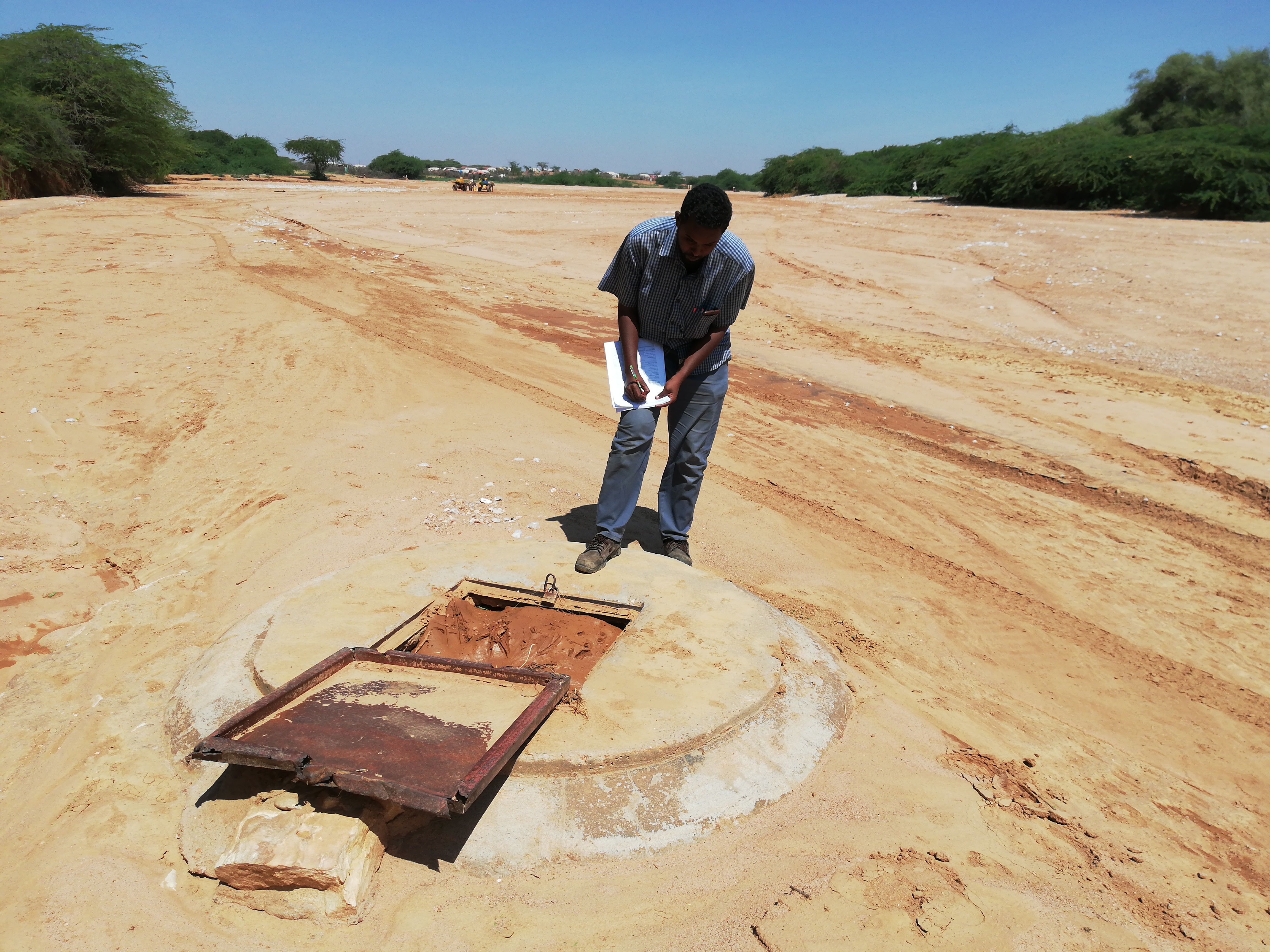 |
| Users | None |
| Permanent? | no |
| Months Used | None |
| Functioning? | Yes |
| Non Function Reason | None |
| No of Humans | 3300 |
| No of Camels | None |
| No of Cattle | None |
| No of Shoats | None |
| Irrigation Area (ha) | None |
| Source Protected? | Yes |
| Dugwell Depth (m) | 8.0 |
| Dugwell SWL | 7.0 (m) |
| Dugwell Yield (m3/hr) | 4.0 |
| Dugwell operating hours (hrs/day) | 5.0 |
| Dugwell draw down (m) | 1.0 |
| Recovery time (hr) | None |
| Reservoir Type | None |
| Reservoir Capacity (m3) | None |
| Pipeline Type | None |
| Pipeline Length (m) | None |
| HouseHold Connections | None |
| Water Point Kiosks | None |
| Troughs | None |
| Source Emergency? | None |
| No of Trucks | None |
| Truck Capacity (m3/hr) | None |
| Pump Type | None |
| Pump Model | None |
| Pump Capacity (m3/hr) | None |
| Pump Level (m) | None |
| Power Source | None |
| Generator Type | None |
| Generator Capacity (kVA/kWh) | None |
| Solar Type | None |
| Solar Capacity (kVA/kWh) | None |
| Supply Condition | None |
| Supply System Condition Notes | None |
| Physical Water Issues | No |
| Physical Problem Reason | None |
| Temperature (°C) | 26.0 |
| pH | 8.05 |
| Electrical Conductivity (µS/cm) | 420.0 |
| Total Dissolved Solids (mg/l) | 26.0 |
| Water Sample Code | No Document |
| Management Type | None |
| WSC | None |
| WSC Established Date | None |
| WSC Male | None |
| WSC Female | None |
| Humans Charged for Water? | No |
| Cost Of Water for Humans (USD) | None |
| Water Charged for Animals? | No |
| Cost Of Water for Animals (USD) | None |
| Last Intervention Agency | None |
| Last Intervention Description | None |
| Last Intervention Date | None |
| Proposed Intervention Description | It needs urgently to drill a new Borehole. |
| Additional Notes | None |
| Metadata Tag | Strategic Boreholes Survey – BHS |
| History | History DWTGOD035 |
×
![]()


